

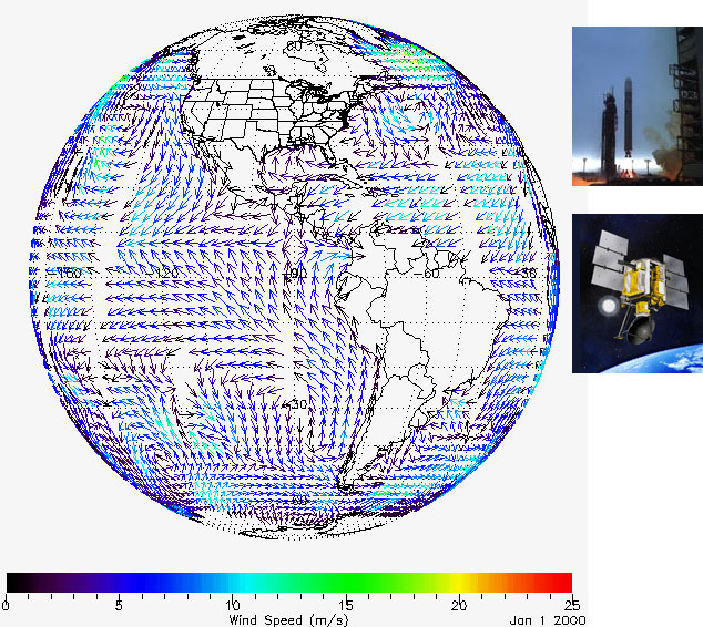
QuikSCATNASA's Quick Scatterometer (QuikSCAT) was lofted into space at 7:15 p.m. Pacific Daylight Time on Saturday (6/19/99) atop a U.S. Air Force Titan II launch vehicle from Space Launch Complex 4 West at California's Vandenberg Air Force Base. The satellite was launched in a south-southwesterly direction, soaring over the Pacific Ocean at sunset as it ascended into space to achieve an initial elliptical orbit with a maximum altitude of about 800 kilometers (500 miles) above Earth's surface. The SeaWinds on QuikSCAT mission is a "quick recovery" mission to fill the gap created by the loss of data from the NASA Scatterometer (NSCAT), when the satellite it was flying on lost power in June 1997. The SeaWinds instrument on the QuikSCAT satellite is a specialized microwave radar that measures near-surface wind speed and direction under all weather and cloud conditions over Earth's oceans. | SeaWinds uses a rotating dish antenna with two spot beams that sweep in a circular pattern. The antenna radiates microwave pulses at a frequency of 13.4 gigahertz across broad regions on Earth's surface. The instrument collects data over ocean, land, and ice in a continuous, 1,800-kilometer-wide band, making approximately 400,000 measurements and covering 90% of Earth's surface in one day. Science Objectives• Acquire all-weather, high-resolution measurements of near-surface winds over global oceans. |